Directory
The Pekoe Trail Stage 10: Dayagama To Horton Plains
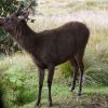
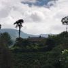
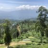
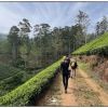
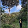
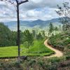
Length 15.1 km Elevation gain 887 m Route type Point to point Try this 15.1-km point-to-point trail near Dayagama, Nuwara Eliya. Generally considered a challenging route, it takes an average of 4 h 31 min to complete. This trail is great for backpacking, hiking, and walking, and it's unlikely you'll encounter many other people while exploring. This stage of the Pekoe Trail is physically and mentally demanding, as well as logistically challenging. It begins in Dayagama, one of the most remote villages in the tea country at the far end of Agarapatana Valley. Very few tourists venture this far – this is a deep tea country experience. Even though the valley lies in the very center of the mountain ranges that form the Sri Lankan tea country, it doesn’t get more remote than this. This stage requires a plan for a ride at the endpoint, the old Far Inn, which is inside Horton Plains National Park. The drive from the starting point to the endpoint is a long one. As the crow flies it isn’t too far, however, the road loops back towards Nuwara Eliya and then back on itself, making for a long journey. The drive takes nearly as long as the hike. The day is physically demanding because it is mostly uphill. That said, the trail is wide and easy to follow, with a manageable gradient. Leaving Dayagama, heading east towards the end of the valley, the full length of the route are tea trails that are wide and easy to follow. It begins heading into dense forest, then enters Horton Plains National Park. It is imperative to note that access to Horton Plains National Park is restricted and requires an entrance fee. Entrance tickets are sold at the entrance to the park on the Nuwara Eliya Road and on the road to Ohiya. The park is governed by strict regulations as there is wildlife and a very sensitive ecosystem. For more information, please visit the Department of Wildlife Conservation website: http://www.dwc.gov.lk/." rel="nofollow" target="_blank">http://www.dwc.gov.lk/.">http://www.dwc.gov.lk/. It is extremely important to travel in a group and ideally with the services of a national guide through the park. As soon as it enters the park, the trail twists and turns up the valley through dense high elevation rainforest. The noises of the jungle echo, as it is the habitat of monkeys, deer, leopards, and a number of endemic bird species. Eventually, the trail joins the main road that traverses the park and shortly ahead is the endpoint. The Pekoe Trail is designed to support development and livelihoods in rural areas of Sri Lanka. Buying goods and services from local businesses helps communities along the trail to thrive. The Pekoe Trail is funded by the European Union (EU) with additional support from the United States Agency for International Development (USAID) and implemented by IESC on behalf of Sri Lanka Tourism. For more information, please visit thepekoetrailsrilanka.com.


