Directory
The Pekoe Trail Stage 06: Watagoda To Kotagala
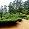
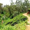
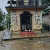
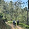
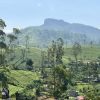
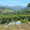
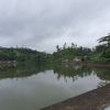
Length14.5 kmElevation gain433 mRoute typePoint to pointHead out on this 14.5-km point-to-point trail near Dikoya, Nuwara Eliya. Generally considered a moderately challenging route, it takes an average of 4 h 14 min to complete. This trail is great for backpacking, hiking, and walking, and it's unlikely you'll encounter many other people while exploring.Starting at the Watagoda Train station, this stage takes a left turn across the railway line and proceeds along a street lined with homes and a volleyball court to the right. The track soon becomes a dyke between two lakes. Shortly after there is a splendid Hindu Kovil on the right-hand side with intricate carvings and a prominent wooden door. Soon the trail descends with switchbacks. Not to be missed is the wonderful banyan tree with an idyllic stream beside it. The trail stretches for a short distance then reaches the railway line. It turns left, traveling in parallel to the tracks for a short distance until the trail forks to the right. The next bit is a delight: a classic tea trail on mostly flat terrain through the Holyrood Estate. There is a descent from the bungalow to the factory, then an exit from the factory premises through a wide-open gate. The path turns to the left and along a tarmac road for a bit. Here there is some interesting artwork painted on the retaining wall. The Pekoe Trail eventually leaves the main road behind and enters a small village street, then back on a tea trail. The path crosses the railway line for a third time and heads toward Thalawakele town. Thalawakelle is the center of the Dimbula tea planting district, the largest growing tea area in Sri Lanka. Once the path leaves Thalawakele behind, the trail is delightful. The elevation changes are manageable and the trail weaves up, down and across small valleys connecting little hamlets. This part feels like a fairy-tale; a bit like “The Shire” in Lord of the Rings, or the Cotswold Way in England. The Thalawakele Tea factory is nestled at the bottom of the valley below. Shortly after a river crossing, the path veers to the left immediately after the village home. As it approaches a small village, the trail turns right and through what looks like someone’s private patio with a stairway forming a sort of bridge that connects two homes. It continues straight on a well-trodden path locals use to get to their vegetable gardens. Next is the first of two small hills found in this stage. Following are tea trails and tea villages, up and down and around. From the next small hill, the views to the west are unbelievable. By looking at the formation of the mountains one can make out the contour of the Nanu Oya river crossed in Thalawakele. This is the deep tea country! Eventually, the trail connects with the main Thalawakele – Hatton road for a short distance. The town here is called Kotagala. There is a brightly painted Hindu Kovil to the right which serves as a nice meeting point for a ride. There is also a train station


