Directory
The Pekoe Trail Stage 07: Kotagala To Norwood (By-Pass Hatton)
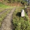
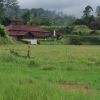
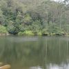
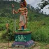
Length 15.8 km Elevation gain 457 m Route type Point to point Get to know this 15.8-km point-to-point trail near Dikoya, Nuwara Eliya. Generally considered a moderately challenging route, it takes an average of 4 h 36 min to complete. This trail is great for backpacking, hiking, and walking, and it's unlikely you'll encounter many other people while exploring. This stage starts in the town of Kotagala. There is a brightly painted Hindu Kovil which serves well as a starting point. The trail leads to the left and follows a straight road up and around the outskirts of Kotagala, into the Drayton Estate and past an old tea factory. Next, the trail passes by the Chrysler’s Farm Tea Factory; shortly after, a small bridge. t leads to the left, where the roads are wide and the terrain is mostly flat for the next bit. It crosses the train line and begins to ascend up a hill. This section feels a little more remote than the last stage. From the top of the hill, Hatton town reveals itself below. Across the train line again, the path turns left at a tea shed and then crosses a small creek onto some tea fields. Soon the path reaches Singamalai Lake, a small lake that provides all the drinking water for Hatton town and the surrounding villages. It also makes for a great picnic spot! Past the lake, there is a series of pathways through rolling hills of green tea and the first peek of Castlereagh Reservoir in the Bogawantalawa Valley. This is known as the “golden bowl”, home to some of the best brews in Sri Lanka. As the path comes over the hill, the Battalgalla Tea Factory and the large red roof of the Dickoya & Maskeliya Cricket Club (DMCC) (also known as The Darrawella Club) present themselves. Soon the trail joins the Agarapatana - Dick Oya road for a short distance before turning to the left at the planters club. A short stop to visit the club is well worth it, then on to cross the river Dick Oya and a small climb up past a small hamlet. With some elevation now, visitors will notice the prevalence of Christian churches here. This part of the country is primarily Tamil, who practice either Christianity or Hinduism. One may even bump into the friendly local pastor, tending to the flock. The trail continues to pass numerous brightly colored line rooms (tea workers’ terraced housing). Castlereagh Reservoir comes into full view, and the descent toward the bottom of the valley begins. The town below is Norwood. The trail meanders down through tea estate paths. Visitors may choose to take a shortcut down the middle, or the main paths that wind at a more leisurely pace. At the bottom is Norwood, another bustling tea town. The bridge marks the beginning of the town and around here is the end of the stage. The Pekoe Trail is designed to support development and livelihoods in rural areas of Sri Lanka. Buying goods and services from local busi


