Directory
The Pekoe Trail Stage 05: Pundaluoya To Watagoda
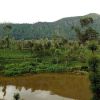
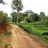
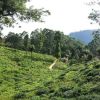
Length13.8 kmElevation gain697 mRoute typePoint to pointCheck out this 13.8-km point-to-point trail near Kumbaloluwa, Nuwara Eliya. Generally considered a moderately challenging route, it takes an average of 4 h 16 min to complete. This trail is great for backpacking, hiking, and walking, and it's unlikely you'll encounter many other people while exploring.PARTIAL CLOSURE: Please note that the last 4 km (approx) have been re-routed and the stage now ends in Pudaluoya, and the start of this stage has been re-routed temporarily. This stage begins at the intersection of a road that leads up to a hydro project and the Tawalanthenna to Thalawakele road. There’s a temple adjacent to the intersection. This is a recognizable landmark for guides and drivers to find adventurers for pick-ups and drop-offs. Across the road, there is a small road leading to homes surrounding the village. The Pekoe Trail descends sharply from here to a river crossing. There are no steps as the trail zig-zags around the village and crosses the occasional patch of paddy land. Once the village trail meets the main road the gradient levels and soon crosses the Pundaloya River. There is a gorgeous waterfall on the mountainside of the crossing. This is the lowest elevation of the stage, in the surroundings of the town of Wewahena. Continuing on the main road, the path forks. The right is a gradual ascent on the Pundaloya to Palawatte Road. This small, tarmacked village road travels through quiet neighborhoods. It leads to the right near a small bridge and heads south toward Thalawakele. Next, the path curves around a mountain to the left and slowly gains elevation over the Kotmale River Gorge. The road is mostly uphill on a mild gradient. It is not a busy road but is shared with the occasional car. There are patches of flowers on the side of the road as well as sections of emerald green paddy and a forested area on the left. There are also a number of small guesthouses and homestay accommodations along this road. Dimbula Hills are to the right across the river. Dimbula is one of the most important and historically significant tea-growing regions of the tea country, as one of the earliest districts to be planted. The path slowly and gradually makes its way into the true heart of the tea country. Ahead, the route follows a road to the right of a small school, where it enters the confines of the Meddecombra Estate, north of Watagoda. It quickly returns to tea trails, on the lower divisions of the estate toward the factory. Toward the end of the stage, there is a final push up to Watagoda. Looking back, there is a great ‘wall’ cutting a north-south line to the right. Some liken this ‘wall’ to that in the TV series, Game of Thrones. It is a breath-taking view. Beyond “the wall’ is the Pundaloya Valley. There is an estate that sits on the very top of the wall, which is one of the most photogenic parts of the tea country. At the end, the trail goes over a small damn and through thr


