Directory
The Pekoe Trail Stage 11: Horton Plains To Udaweriya
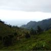
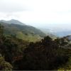
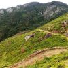
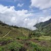
Length13.0 kmElevation gain283 mRoute typePoint to pointHead out on this 13.0-km point-to-point trail near Dayagama, Nuwara Eliya. Generally considered a challenging route, it takes an average of 3 h 56 min to complete. This trail is great for backpacking, hiking, and walking, and it's unlikely you'll encounter many other people while exploring.This stage starts at the Farr Inn, the old hunting lodge for high-ranking British colonial officials, which today serves as a visitor center. Now run by the Department of Wildlife Conservation, the old inn is situated next to the car park from which almost all visitors start the walk to World's End. This is the highest point of the entire Pekoe Trail. Depending on the time of year, or even the time of the day, it can be cold, windy, misty, or open skies. During the months of May through to December, clouds roll over the plains in an eastward direction, so close to the ground it feels they can be touched with the hand. In January and February, the skies are blue, the air is dry, and the sun beats down. Along the road towards Ohiya, the path exits through the park’s eastern gate zig-zags down. There is a dirt track that peels off to the right through a small section of woods – this is the beginning of the famous “Devil's Staircase”, the steepest downward descent of The Pekoe Trail. The name Devil's Staircase was most likely given by Scottish planters living in the area and taken from the long-distance footpath on the West Highland Way in the Scottish Highlands. There are other so-called “Devil Staircases” in various parts of the world; one in New Zealand and one in the state of Oregon. The good news is there are no stairs! It’s a track. The Devil's Staircase is often described as starting way down off the main Balangoda-Haputale Road and ending at the entrance of the Horton Plains National Park. There are tour companies that offer hiking the staircase as an activity and the path is perfectly suited for hikers, but definitely not for a motorized vehicle. The Pekoe Trail covers only the top section of the Devil's Staircase, from Ohiya-Horton Plains road to a small village where a trail cuts across the mountain around and over to Udaweriya Valley. The views are truly breathtaking as the path curves around the mountain. On a clear day there are views to Udawalawe National Park and, on occasion, the coastline. The route leaves one remote valley behind and enters the next. This is the lowest point of this stage. This valley is called the “hidden valley” because it lies on the very edge of tea country and is south-facing. The topography is so dramatic there are very few south-facing tea growing valleys in this area. Eventually, the path travels past Udaweriya Manager’s Bungalow. As the ascent begins, eyes are drawn upwards to the old, abandoned Udaweriya Tea Factory. The factory is now largely a skeleton of steel beams. Continuing on, there is a clear pass through neat terraces of vegetables planted left an


