Directory
The Pekoe Trail Stage 04: Tawalantenne to Pundaluoya
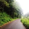
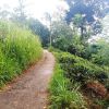
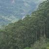
Length13.4 kmElevation gain630 mRoute typePoint to pointExperience this 13.4-km point-to-point trail near Tawalantenna CP, Nuwara Eliya. Generally considered a moderately challenging route, it takes an average of 4 h 27 min to complete. This trail is great for backpacking, hiking, and walking, and it's unlikely you'll encounter many other people while exploring.PARTIAL CLOSURE: Please note that the last 4 km (approx) have been re-routed and the stage now ends in Pudaluoya, and the start of this stage has been re-routed temporarily. Due to the recent adverse weather conditions the original route no longer meets the stringent safety standards of The Pekoe Trail. Restoration work is currently underway. In the beginning of stage four of The Pekoe Trail, there is a walk through the residential areas of two towns: Tawalanthenna and New Kotmale. The trail then narrows and travels on small village roads with village housing on either side and the occasional rice paddy cultivation. It gradually descends toward the crossing of the Ramboda Oya where the hydro-plant is located. Once across the Ramboda Oya, The Pekoe Trail veers up and to the right on a village path. Soon there is a signboard pointing to a school above the village road. It crosses the schoolyard and up an ascending trail. This enters the Greenfield Estate, a private estate with the blessing of the owners. The path goes through a line of mango trees into the residential part of the estate. Delicious mulberries are on either side. Upon exiting the estate, the trail levels out and the reservoir can be seen below. This large reservoir is called the Kotmale Dam, the second-largest hydroelectric power station in Sri Lanka. Construction on the dam began in August 1979 and was ceremonially completed in February 1985. The dam forms the Kotmale Reservoir, which was renamed to Gamini Dissanayake Reservoir. Gamini Dissanayake was a prominent Sri Lankan politician. Legend says ancient kings of Gampola Kingdom used to hide among the inaccessible terrain around Pussellawa and Kotmale when threatened by enemies. The Sinhalese prince, Dutugamunu, is said to have taken refuge in Kotmale to escape the wrath of his father, King Kavantissa. Kotmale is also where the Kandyan Kings hid the sacred tooth relic during periods of political instability, the last occasion being during the British occupation in 1815. The stupa seen at the far end of the lake is called the Kotmale Mahaweli Maha Seya. It serves as a reminder of the eighteen shrines/temples that were submerged with the construction of the Kotmale reservoir. Shortly after some flat terrain begins a gradual ascent on what is clearly an abandoned old British-engineered road. Though in disrepair, the road has the perfect gradient and width, ideal for bullock carts and small vehicles. The higher the climb, the more overgrowth on the sides. Worry not, as this old road resolves into a modern, perfectly tarmacked road. What lies ahead are the remains of an ol


