The Pekoe Trail Stage 19: Ettampitiya To Loonuwatte
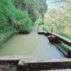
Length18.5 kmElevation gain689 mRoute typePoint to pointEnjoy this 18.5-km point-to-point trail near Ettampitiya, Badulla. Generally considered a challenging route, it takes an average of 5 h 53 min to complete. This trail is great for backpacking, hiking, and walking, and it's unlikely you'll encounter many other people while exploring.This stage starts at Ettampitiya, a small yet busy town with plenty of shops to stock for the walk. The stage is divided into two very distinct parts. The first part is a gradual descent towards the crossing of the region’s most distinctive river the Uma Oya. The Uma Oya is born at Pidurutalagala, the tallest mountain in Sri Lanka towering over Nuwara Eliya. The river eventually connects with the great Mahaweli, the longest river in Sri Lanka. The crossing of the Uma Oya is a very significant landmark of the trail, as this is the point from where the trail gradually begins to ascend to Nuwara Eliya. The second part runs through some of the most remote parts of the tea country; there is very little tourism here. This part of the country looks a lot like Bali and are definitely off the beaten path here… Begin by walking on the main Hali-Ela – Welimada road and then right onto a gravel road. The track is immediately surrounded by tea fields with a few village homes peppered around. The tea trails this route is on are connected with a tarmacked village road, and then The Pekoe Trail peels off to the right and the track is back on a tea estate road that goes all the way down to the Ettampitiya Estate Bungalow. Continue descending on the estate road and then, hikers will have to dog-leg back up, this time on a tarmacked village road. The track is uphill on the road and, at the fork, take the right trail. It’s a very straight path down the hill passing a few village homes on either side. There is also a local school on the right-hand side called Dehiwwina. The track later arrives at the Pallawela Temple, a lovely and serene Buddhist temple. Continue descending and the trail becomes gradually steeper. Unfortunately, there is a section of the trail that are steps, but not for long, and at the very bottom awaits a truly delightful sight and experience – an old suspension bridge that will need to be crossed. There is also a concrete path that crosses the river further down. The river is a lively place – keep an eye out for kids swimming or villagers washing their clothes. Once the river is crossed, the trail comes across a local hydro plant and immediately after that the main Hali-Ela – Welimada Road again. There is no option but to walk on the side of the road. Then, the river will have to be crossed over again – there is a clear concrete bridge across. The next part is all uphill, zig-zagging past village homes. The views of the Uma Oya valley on the right are magnificent. Head onto the tarmac road, then back off the road onto a tea trail, and then loop back onto the road. At the next post, peel off to the left and th


